Mainz hiking trails
Hiking in Mainz: Discover beautiful hiking trails for relaxing walks, enjoyment of nature and attractive excursion destinations in Mainz and the surrounding area.
Fancy a short hike without a long journey? No problem! Discover one of Mainz's hiking trails, which guarantee relaxation and beautiful surroundings!
Bänkelches Weg in Mainz-Laubenheim

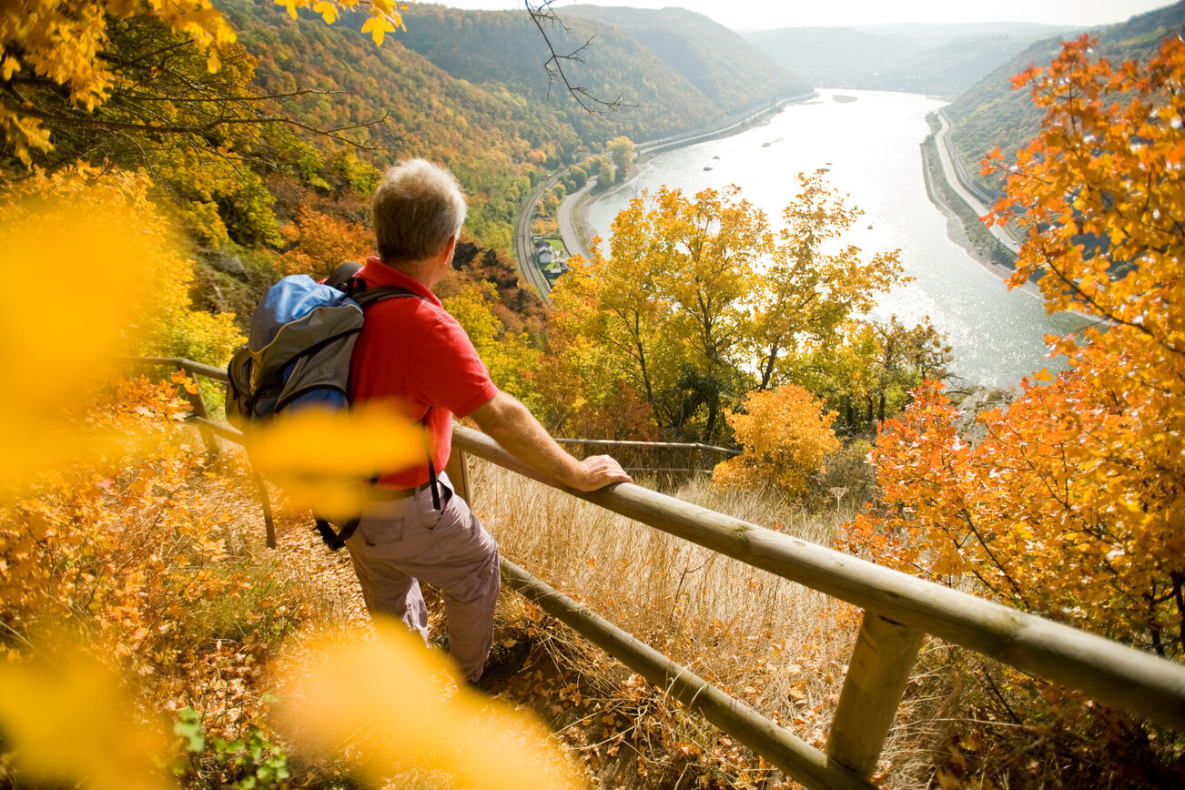
The walking trail starts at the park in Mainz-Laubenheim (diagonally opposite Laubenheim train station) and leads into the vineyards. The total length of the hike is 6 kilometers. On nature trails with mainly grassy surfaces, farm tracks, and through romantic sunken paths, stairs lead back to the old town center. Along the route, sustainably designed benches invite you to "take a break" and "enjoy the view." From the Taunus to the Odenwald, the view sweeps over the Rhine Valley and lingers on the skyscrapers of Frankfurt. In the old town center, there are information boards on historic buildings, such as the founding winery of the Kupferberg sparkling wine cellars. The tour is signposted and can also be downloaded to your cell phone using a QR code. The route is not barrier-free. There are a variety of places to stop for refreshments in the town center.
Three bridges walk (with panoramic view of Mainz)

It connects Mainz with the AKK suburbs and is one of the most popular routes for walking, jogging, or cycling: the "Three Bridges Walk." This easy loop takes you along particularly scenic stretches on both sides of the Rhine and Main rivers.
The walk starts at Stresemann-Ufer in front of City Hall, heading upstream along the Malakoff Terrace, past the Hyatt Regency’s beer garden, over the swing bridge at Winterhafen, and on to Victor-Hugo-Ufer. Here, Michelin-starred chef Frank Buchholz invites you to his restaurant “Bootshaus” to enjoy culinary delights with a view from the panoramic windows.
The route continues steeply uphill to the first river crossing of the walk: over the railway bridge. From the bridge, you have a magnificent view across the Rhine to Mainz and the Taunus Mountains, as well as the confluence of the Main and Rhine rivers—the Mainspitze. Once you’ve crossed the bridge, the path leads past the Gustavsburg sports facilities to the Main Bridge, which takes walkers to Kostheim. Passing the parish church of St. Kilian and the wine fountain, the route heads toward the Kasteler Maaraue.
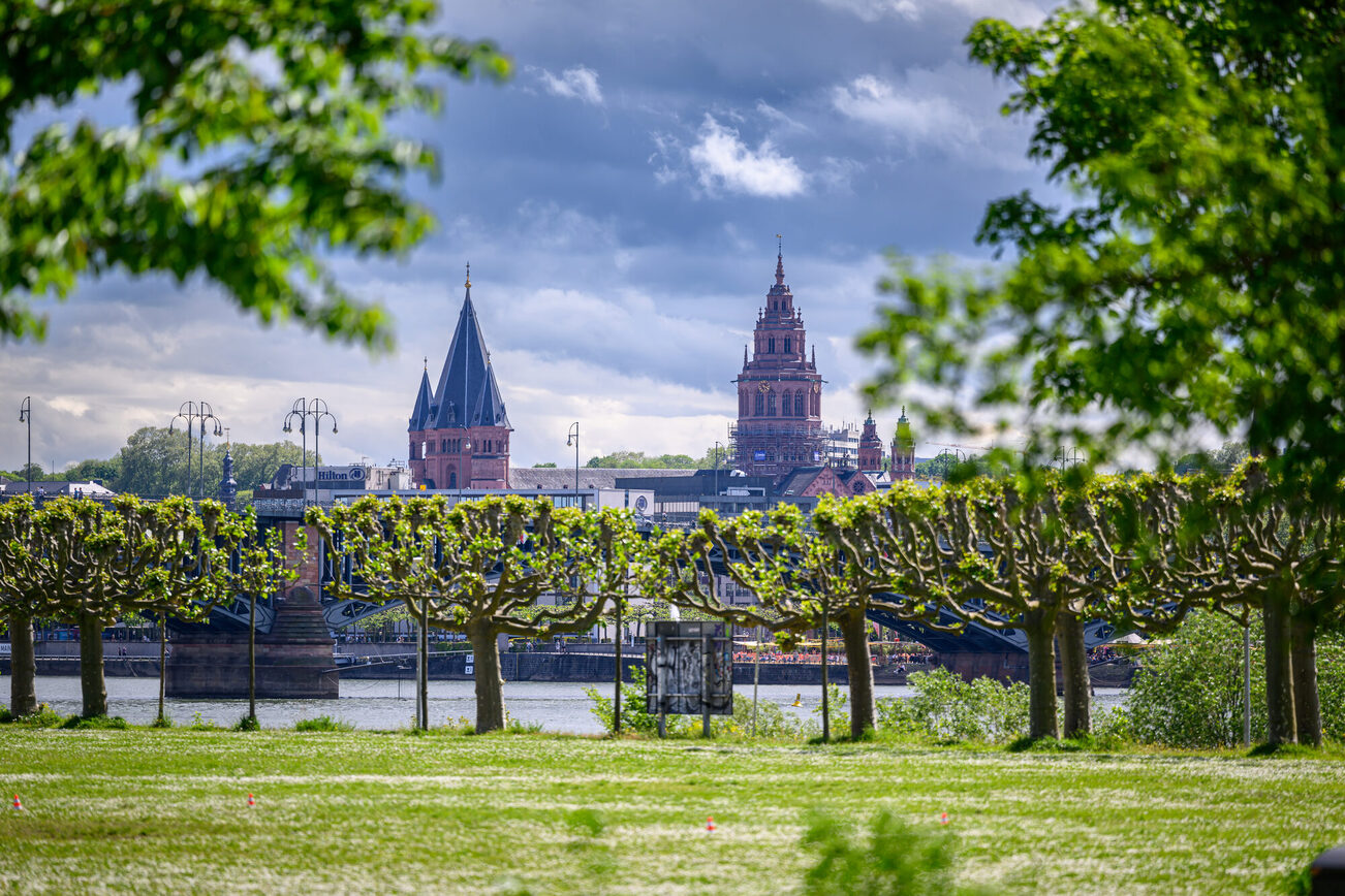
The route continues along the Main River to the Rhine-Main estuary. As you pass the Maaraue outdoor pool heading downstream, the city skyline of Mainz is visible across the river. After crossing the small Floßhafen Bridge, the route follows the Kastel beach promenade and the Reduit. Diagonally across from the fortress lies the restaurant-sailing ship "Pieter Van Aemstel." Here, too, the panoramic view of Mainz is impressive.

Finally, cross the Theodor-Heuss-Brücke bridge back to the Mainz side of the Rhine. After this eight-kilometer walk, the numerous wine bars and pubs in Mainz city center offer plenty of opportunities to refuel.
If this tour is not enough for you, instead of walking back to Mainz via the Theodor Heuss Bridge, you can continue along the green spaces on the Kastel bank of the Rhine. The walk then leads over the Kaiser Bridge (Eisenbahnbrücke Nord) past the customs and inland port back to the Mainz side. After 14 kilometers, it's worth stopping off at one of the pubs or cafés in Mainz's Neustadt district.
Small Mainzer Höhenweg

The high-alpine "Mainzer Höhenweg" runs through the Pitztal Alps and has a little brother: the "Kleiner Mainzer Höhenweg." Both are maintained by the Mainz section of the German Alpine Club.
The Kleiner Mainzer Höhenweg offers unique perspectives and panoramic views of Mainz, the surrounding countryside and villages, as well as the Ober-Olmer and Lenneberg forests. With a total length of 33.6 kilometers, the trail runs westward around the city of Mainz. The route passes through the following localities: Mainz-Laubenheim, Gau-Bischofsheim, Harxheim, Ebersheim, Klein-Winternheim, Lerchenberg/Ober-Olmer-Wald, Finthen, Budenheim/Lennebergwald, and Mombach. There is a 155-meter elevation difference between the lowest point of the Mainz Basin and the Rhine-Hessian Plateau. On a clear day, hikers will therefore always have a view of one of the low mountain ranges from Laubenheimer Höhe. The panorama stretches from the Rheingau, across the Hochtaunus and the Frankfurt skyline, all the way to the Odenwald. The highest point of the route is near Mainz-Lerchenberg at 240 meters.
There are signposted access routes to the train stations in Mainz-Mombach, Budenheim, and Klein-Winternheim, as well as to the tram terminal stops in Mainz-Finthen and Mainz-Lerchenberg.
The DAV Mainz chapter typically organizes a guided hike once a year on the "Kleiner Mainzer Höhenweg" for all residents of Mainz and the surrounding area. Current information and a detailed breakdown of the stages are available at dav-mainz.de.
The hiking trail is marked with a stylized white edelweiss on a green background.
RhineTerrassenWeg - Mainz stage

The RheinTerrassenWeg, which is approximately 60 kilometers long in total, runs between Mainz and Worms along the Rhine Valley. The trail is perfect for scenic long-distance hikes or varied short walks. The route, which also includes small loop trails along the main path, winds through vineyards, takes you to historic sites, and passes by interesting architectural landmarks.
The approximately 15-kilometer-long “Mainz” stage of the route begins in Bodenheim. With a view of St. Alban’s Church, the trail heads into the vineyards. Via the Erich-Koch Höhenweg, hikers reach the Laubenheimer Höhe—with a bit of luck, they’ll be rewarded here at an elevation of 196 meters with an impressive panoramic view stretching all the way to the Frankfurt skyline. The trail continues along the former quarry toward the banks of the Rhine. The Römisches Theater train station marks the end of this stage.
Those who wish can also hike from Bodenheim toward Nierstein and Oppenheim. This stage is approximately 16 kilometers long.
The railway line running parallel to the RheinTerrassenWeg makes it easy to return to the starting point.
For more information, visit rheinhessen.de.
Wine trails

In addition to the Kleiner Mainzer Höhenweg and the RheinTerrassenWeg, which wind through vineyards and wine-growing regions along their routes, you can also take part in the wine hike in Ebersheim.
Information on wine hikes in Rheinhessen and current dates can be found at weinwanderung.net.
In addition, individual wineries in the Mainz wine-growing region offer guided wine hikes upon request, and the Mainz Tour Guide Association also has vineyard hikes on its program.
Also worth checking out: the offerings from the mainz STORE / Tourist Information—such as a vineyard hike with wine tasting. You
can enjoy an informative short walk focused on wine around the Laubenheimer Höhe. The Wine Discovery Trail provides a closer look at the grape varieties typical of Mainz.